


Latest Version
3.0.32
July 12, 2025
NGN IT Solutions GmbH
Tools
Android
0
Free
eu.ngn.fotogis
Report a Problem
More About Foto-GIS
Revolutionize Your Workflow with Photo Documentation: Save Time and Energy
In today's fast-paced world, efficient project management is crucial. One of the most effective ways to streamline your workflow is through photo documentation. This innovative approach can save you up to 80% of your time and energy, allowing you to focus on what truly matters—delivering exceptional results.
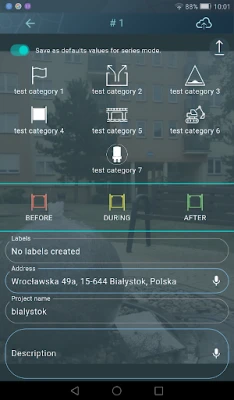
Automated Image Assignment Based on Geo-Coordinates
With advanced technology, images are automatically assigned to specific projects using geo-coordinates. This includes various locations such as districts, new construction areas, construction sites, and defined GIS polygons. By leveraging photo location data (GPS), you can ensure that every image is accurately categorized and easily accessible.
Before utilizing this feature, it is essential to create and release individual construction projects within the system. This initial setup allows for seamless integration and organization of your photo documentation.
Access Through a State-of-the-Art GIS-Based User Interface
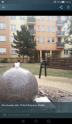
Once your projects are set up, the photos become available through a cutting-edge GIS-based web user interface. This user-friendly platform allows all designated users to access the images effortlessly. You can assign group rights individually, ensuring that the right people have the right access to the information they need.
Secure Online Archive with GIS Cloud Storage
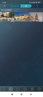
All photos are automatically synchronized with a dedicated online archive, known as GIS Cloud Storage. This secure storage solution guarantees that your data is only stored on European servers, adhering to strict data protection regulations. With this level of security, you can rest assured that your valuable images are safe from unauthorized access.
Comprehensive Photo Archive with Mapping Capabilities
The photo archive can accommodate up to 1 million pictures, displaying them precisely on an interactive map. This feature includes the direction of each image, providing context and enhancing the usability of your documentation. The online archive is permanent, offering a more reliable solution than traditional data carriers.
Benefits of Photo Documentation in Project Management
Implementing photo documentation in your project management strategy offers numerous benefits:
- Time Efficiency: Automating the assignment and storage of images significantly reduces the time spent on manual documentation.
- Improved Organization: With geo-coordinates and a user-friendly interface, finding and managing images becomes a breeze.
- Enhanced Collaboration: By granting access to specific users, teams can collaborate more effectively, ensuring everyone is on the same page.
- Data Security: Storing images in a secure online archive protects your data from loss or unauthorized access.
- Long-Term Accessibility: The permanent nature of the online archive ensures that your documentation is always available when needed.
Conclusion: Embrace the Future of Project Management
Incorporating photo documentation into your project management processes is not just a trend; it’s a necessity for those looking to enhance efficiency and productivity. By automating image assignment, utilizing a state-of-the-art user interface, and ensuring data security through GIS Cloud Storage, you can save significant time and energy. Embrace this innovative approach and watch your project management capabilities soar.
Rate the App
User Reviews


Popular Apps


Editor's Choice