Latest Version
2.3.8
November 25, 2024
Province of British Columbia, Canada
Tools
Android
0
Free
ca.bc.gov.WildfireInformation
Report a Problem
More About BC Wildfire Service
Comprehensive Guide to Wildfire Management Tools: Features and Benefits
In an era where wildfires pose significant threats to communities and ecosystems, having access to reliable information and tools is crucial. This article explores the essential features of wildfire management tools, focusing on interactive maps, dashboards, and reporting capabilities that empower users to stay informed and safe.
Interactive Wildfire Map: Your Real-Time Resource
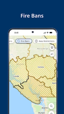
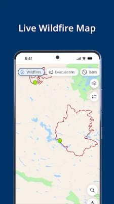
The interactive wildfire map serves as a vital resource for anyone affected by or interested in wildfire activity. This tool provides a wealth of information, including:
- Wildfire Perimeters: When available, users can view the boundaries of active wildfires, helping them understand the extent of the threat.
- Burn Prohibitions: Stay informed about areas where burning is restricted to prevent new fires from igniting.
- Smoke Forecasts: Get real-time updates on smoke conditions, which can impact air quality and health.
- Weather Conditions: Access current weather data to assess how conditions may affect fire behavior.
- Evacuation Information: When available, receive timely updates on evacuation orders to ensure safety.
- Road Conditions: Stay updated on road accessibility, which is crucial during emergencies.
Wildfire Dashboard: Stay Updated with the Latest Information
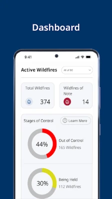
The wildfire dashboard is an essential feature that aggregates critical updates from the BC Wildfire Service. Key components include:
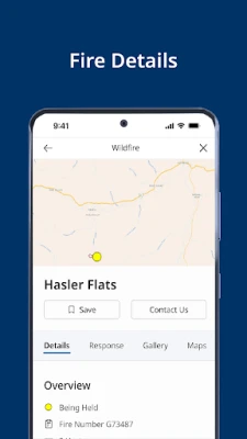
- Incident Statistics: Access real-time data on active wildfires, including their size and containment status.
- Daily Situation Reports: During peak fire season, receive daily updates that summarize the current wildfire situation, helping you stay informed.
Saved Locations and Incident Information: Personalize Your Alerts
One of the standout features of wildfire management tools is the ability to save locations and incidents. This personalization allows users to receive tailored notifications about:
- Evacuation Orders and Alerts: Get immediate notifications about any evacuation orders affecting your saved locations.
- Burn Prohibitions: Stay informed about restrictions in your area to prevent accidental ignitions.
- New Wildfires: Receive alerts about new wildfires that may impact your saved locations.
- Weather Updates: Get customized weather alerts that could affect fire conditions.
- Fire Prohibitions: Stay updated on any new fire prohibitions in your area.
- Customizable Notifications: Tailor your notification preferences to ensure you receive the most relevant information.
Report a Fire: Quick and Efficient Incident Reporting
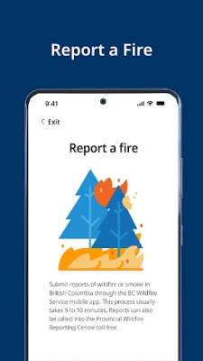
In the event of a wildfire, timely reporting can make a significant difference. The reporting feature allows users to:
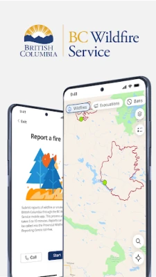
- In-App Incident Reporting: Quickly report a fire directly through the app, ensuring that authorities are notified as soon as possible.
- Offline Reporting: Even without internet access, users can report fires, ensuring that no incident goes unreported.
Conclusion: Empowering Communities Through Technology
Wildfire management tools are essential for enhancing community safety and preparedness. With features like interactive maps, comprehensive dashboards, personalized notifications, and efficient reporting systems, these tools empower individuals to stay informed and take action when necessary. By leveraging technology, we can better protect our communities and natural resources from the devastating effects of wildfires.
Rate the App
User Reviews
Popular Apps





Editor's Choice


