


Latest Version
January 01, 2026
Esri
Tools
Android
0
Free
com.esri.responder.eleven
Report a Problem
More About ArcGIS Responder 11
Unlocking the Power of ArcGIS Mission: A Comprehensive Guide
In today's fast-paced world, situational awareness is crucial for organizations operating in dynamic environments. ArcGIS Mission emerges as a powerful solution, seamlessly integrated with Esri’s renowned ArcGIS Enterprise platform. This tactical situational awareness tool empowers organizations to create, share, and manage missions effectively, utilizing integrated maps, teams, and various mission-related materials such as photographs, documents, and map products. With ArcGIS Mission, organizations gain a real-time perspective of their operational landscape, enabling remote and mobile users to answer the pressing question: “What’s happening around me right now?”
Understanding ArcGIS Mission
ArcGIS Mission is designed to enhance situational awareness by providing a comprehensive view of ongoing operations. It allows teams to collaborate efficiently, ensuring that everyone involved has access to the same information and resources. This integration fosters a unified approach to mission management, making it easier for organizations to respond to challenges as they arise.
The Role of Responder: Mobile Connectivity at Its Best
As the mobile component of ArcGIS Mission, Responder plays a pivotal role in maintaining communication and collaboration among team members. This mobile application enables operators to stay connected with their teammates and other mission participants through real-time messaging and reporting. Responder ensures that critical information flows seamlessly, enhancing the overall effectiveness of mission operations.
Key Features of ArcGIS Mission
ArcGIS Mission is equipped with a range of features designed to optimize mission management and enhance situational awareness. Here are some of the standout functionalities:
- Chat Messaging: Users can send text messages, attachments, and sketches (map markups) to facilitate communication.
- Secure Connection: The application provides a secure, protected connection to ArcGIS Enterprise, ensuring data integrity and confidentiality.
- Active Mission Participation: Users can view and engage in active missions within ArcGIS Enterprise, promoting collaboration.
- Interactive Maps: The platform allows users to explore mission maps, layers, and other resources, enhancing situational understanding.
- Instant Messaging: Users can send instant messages to other participants, teams, and all mission members, ensuring timely communication.
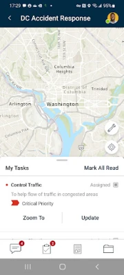
- Task Management: Users receive, view, and respond to user-specific tasks, streamlining mission workflows.
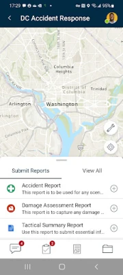
- Optimized Reporting: The application features an optimized report form, enabling users to create and view reports directly from the field.
- Map Sketching: Users can create simple map sketches to communicate and collaborate effectively with other mission participants.
Enhancing Operational Efficiency
By leveraging the capabilities of ArcGIS Mission, organizations can significantly enhance their operational efficiency. The integration of real-time data and communication tools allows teams to make informed decisions quickly. This agility is essential in high-stakes environments where every second counts.
Considerations for Mobile Users
While the benefits of using ArcGIS Mission and Responder are substantial, it is important to note that continued use of GPS running in the background can dramatically decrease battery life. Users should be mindful of their device's battery status and manage GPS settings accordingly to ensure uninterrupted access to mission-critical information.
Conclusion: Empowering Organizations with ArcGIS Mission
ArcGIS Mission stands out as a vital tool for organizations seeking to enhance their situational awareness and operational effectiveness. With its robust features and seamless integration with ArcGIS Enterprise, it empowers teams to collaborate efficiently and respond to challenges in real time. By adopting ArcGIS Mission, organizations can ensure they are always prepared, informed, and ready to act in any situation.
In a world where information is power, ArcGIS Mission provides the clarity and connectivity needed to navigate complex operational landscapes successfully.
Rate the App
User Reviews


Popular Apps


Editor's Choice