

Latest Version
master-dev
February 19, 2025
OPENGIS.ch
Tools
Android
0
Free
ch.opengis.qfield_dev
Report a Problem
More About QField for QGIS - Unstable
Unlocking the Power of QField for QGIS: Your Guide to the Latest Development Version
In the ever-evolving world of Geographic Information Systems (GIS), staying updated with the latest tools is crucial for professionals and enthusiasts alike. One such tool is QField for QGIS, a mobile application designed to enhance your field data collection experience. This article delves into the current development version of QField, highlighting its purpose, features, and best practices for use.
What is QField for QGIS?
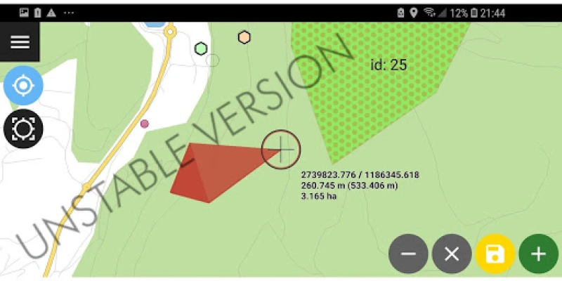
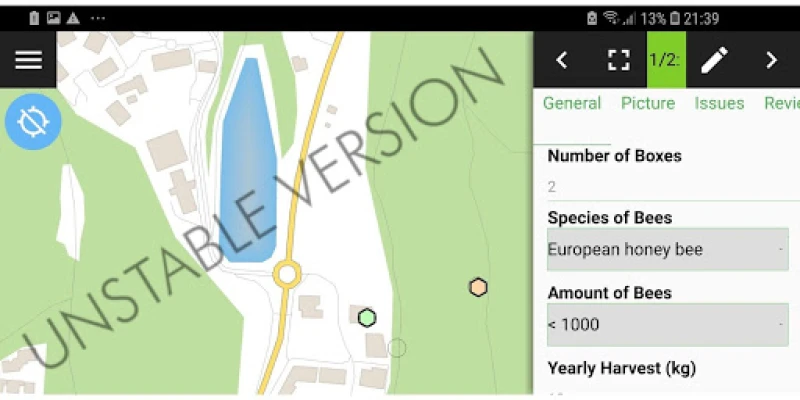
QField for QGIS is a powerful mobile application that allows users to collect and manage geospatial data directly from their mobile devices. It seamlessly integrates with QGIS, a popular open-source desktop GIS software, enabling users to work efficiently in the field. The development version of QField is specifically designed for testing new features and identifying bugs, making it an essential tool for developers and early adopters.
Why Use the Development Version?
The development version of QField is not just a beta test; it serves a vital role in the evolution of the application. Here are some key reasons to consider using this version:
- Access to New Features: Users can explore and test the latest functionalities before they are officially released. This allows for a firsthand experience of upcoming enhancements.
- Bug Identification: By using the development version, you contribute to the improvement of the app by reporting bugs and issues, helping developers refine the software.
- Community Engagement: Engaging with the development version fosters a sense of community among users and developers, promoting collaboration and feedback.
Who Should Use the Development Version?
The development version of QField is primarily intended for:
- Developers: Those involved in the development of QGIS or QField can benefit from testing new features and providing feedback.
- Advanced Users: Experienced users who are comfortable navigating potential bugs and issues can take advantage of the latest features.
- Researchers: Academics and researchers looking to experiment with new functionalities for their projects may find the development version particularly useful.
Best Practices for Using QField Development Version
While the development version offers exciting opportunities, it’s essential to follow best practices to ensure a smooth experience:
- Backup Your Data: Always back up your projects and data before using the development version. This precaution protects your work from potential bugs.
- Stay Updated: Regularly check for updates to the development version to access the latest fixes and features.
- Report Issues: If you encounter bugs or glitches, report them to the development team. Your feedback is invaluable in improving the application.
Transitioning to the Stable Version
While the development version is excellent for testing, it’s crucial to transition to the stable version of QField for production use. The stable version is thoroughly tested and optimized for reliability, making it suitable for critical fieldwork. To switch, simply download the official QField for QGIS app from the appropriate app store.
Conclusion
The development version of QField for QGIS is a powerful tool for those looking to stay ahead in the GIS field. By testing new features and providing feedback, users play a crucial role in shaping the future of the application. However, for production purposes, always opt for the stable version to ensure the reliability and integrity of your data collection efforts. Embrace the future of GIS with QField and enhance your fieldwork experience today!
Rate the App
User Reviews


Popular Apps


Editor's Choice