

Latest Version
3.4.7 - Ebo
February 17, 2025
OPENGIS.ch
Tools
Android
0
Free
ch.opengis.qfield
Report a Problem
More About QField for QGIS
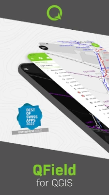
QField: Revolutionizing Field Data Collection with Award-Winning Technology
QField has been honored with the esteemed Best of Swiss Apps Award 2022 in the enterprise category, showcasing its exceptional capabilities in the realm of field data collection and management.
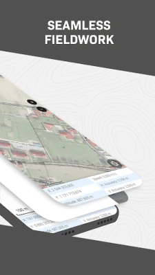
What is QField?
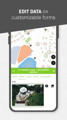
QField is a powerful mobile application built on the robust foundation of the QGIS open-source project. It empowers users to access fully configured GIS projects directly in the field, offering a seamless experience for data collection and analysis. With features like customized forms, tailored map themes, and versatile print layouts, QField brings the extensive functionalities of QGIS right to your fingertips.
Key Features of QField
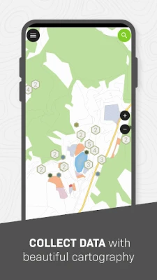
QField leverages a variety of open-source libraries, including GDAL, SQLite, and PostGIS, to provide users with the ability to read, display, and edit a diverse range of spatial datasets. Whether you are working with vector or raster data, QField ensures that you can view and modify your datasets anytime, anywhere. This flexibility is crucial for professionals who need to work on-the-go, whether the data is stored on their devices, shared via email, or transferred through USB connections.
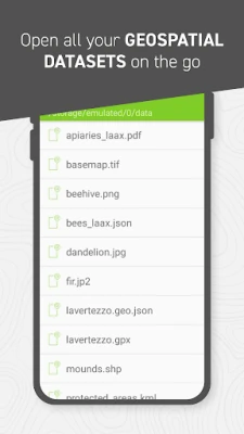
Supported Data Formats
QField supports an extensive array of data formats, making it a versatile tool for various GIS applications. The supported formats include:
- QGIS project files: .qgs, .qgz, and geopackage-embedded projects
- SQLite-based databases: Geopackage and Spatialite
- Vector datasets: GeoJSON, KML, GPX, and Shapefile
- Raster datasets: GeoTIFF, Geospatial PDFs, WEBP, and JPEG2000
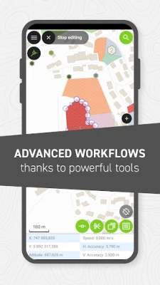
Enhancing Field Data Collection
One of the standout features of QField is its ability to utilize location permissions. This functionality allows the application to overlay a marker that indicates the device's location on top of spatial projects and datasets. Users can also access vital location details, including latitude, longitude, elevation, and accuracy, while entering data. This feature significantly enhances the accuracy and reliability of field data collection.
Need Additional Features? We’re Here to Help!
If you find that QField lacks certain capabilities that you require, OPENGIS.ch is ready to assist you with the implementation of new features. Our team is dedicated to enhancing your experience with QField and ensuring that it meets your specific needs. For inquiries, please reach out to us at https://www.opengis.ch/contact/.
Report Issues and Contribute to QField
To maintain the high quality of QField, we encourage users to report any bugs or issues they encounter. Your feedback is invaluable in helping us improve the application. Please file an issue at https://qfield.org/issues.
Conclusion
QField stands out as a leading solution for field data collection, combining the power of QGIS with the convenience of mobile technology. Its award-winning status reflects its effectiveness and reliability in the enterprise sector. With its extensive support for various data formats and robust features, QField is an essential tool for professionals in the GIS field. Embrace the future of field data collection with QField and experience the difference it can make in your projects.
Rate the App
User Reviews


Popular Apps


Editor's Choice