Latest Version
9.2.3
December 14, 2024
HPB Labs
Education
Android
0
Free
de.mediaz.mxapp.hpbgeodefree
Report a Problem
More About World atlas & world map MxGeo
Unlock the World: Your Ultimate Guide to the MxGeo World Atlas App
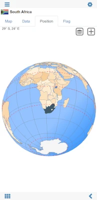
In an age where knowledge is at our fingertips, the World Atlas & World Map MxGeo app stands out as a premier educational tool designed specifically for smartphones and tablets. This comprehensive application offers a wealth of information about over 250 countries and territories, making it an essential resource for geography enthusiasts, students, and travelers alike.
Comprehensive Global Coverage
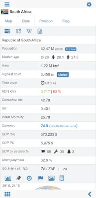
The MxGeo app provides essential maps, flags, and basic data for more than 250 countries and territories worldwide. Users can easily search for specific countries, major cities, rivers, mountains, lakes, or even precise coordinates. This extensive database ensures that you have access to a wealth of geographical information at your fingertips.
Interactive Maps for Engaging Learning
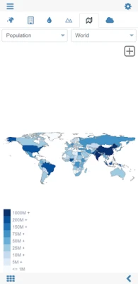
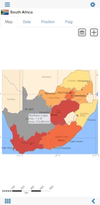
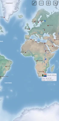
One of the standout features of the MxGeo app is its interactive political world and continent maps. These maps are not only visually appealing but also user-friendly, allowing you to explore the world effortlessly. The shaded relief layer enhances the visual experience, providing a three-dimensional perspective of the terrain.
Fun and Educational Geography Quizzes
Learning geography has never been more enjoyable! The app includes a geography quiz challenge that allows users to test their knowledge in a playful manner. With six engaging geo guessing games, you can:
- Test your knowledge about the capitals of Africa
- Identify ISO country codes
- Recognize country flags based on outline maps
- Guess top-level domains for each country
- Identify highlighted countries on a virtual globe
- Learn about the mountains of Africa
This interactive approach makes the app suitable for everyone, from children to adults, seniors, and educators. It’s a fantastic way to prepare for your next trip abroad or to enhance your geography lessons.
Explore Africa and Beyond
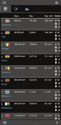
The MxGeo app offers comprehensive maps and data for all African countries, including choropleth maps that illustrate area and population statistics. Additionally, the world clock and distance calculator features allow you to plan your travels effectively, making it easier to understand time zones and distances between locations.
Discover Unique Geographic Facts
Curious about the smallest or largest countries in the world? The World Explorer feature provides fascinating insights into various countries, enhancing your geographic literacy. For instance, do you know where Mount Kilimanjaro is located? With the MxGeo app, you can easily find out and learn more about the world around you.
Offline Access for On-the-Go Learning
One of the most significant advantages of the MxGeo app is that it does not require an online connection. This feature allows you to explore the world through political maps and continent maps even when you’re offline. Whether you’re traveling in remote areas or simply want to learn without internet access, the app has you covered.
Customizable Map Themes
Personalization is key in today’s digital world. The MxGeo app allows users to create their favorite color themes or choose from various color schemes for map displays. This customization enhances the user experience, making it visually appealing and tailored to individual preferences.
Free and Pro Versions Available
The free version of the MxGeo app includes comprehensive data and maps for all African countries, making it an excellent starting point for users. For those seeking more detailed information, the World Atlas & World Map MxGeo Pro version offers extensive data and maps, including regional units and capitals for over 260 countries and territories across Europe, Asia, North America, Africa, Oceania, and South America.
Conclusion: Your Gateway to Global Knowledge
The World Atlas & World Map MxGeo app is more than just a digital map; it’s a gateway to global knowledge. Whether you’re preparing for a geography lesson, planning your next adventure, or simply looking to expand your understanding of the world, this app is an invaluable resource. Download it today and embark on a journey of discovery that transcends borders!
Rate the App
User Reviews
Popular Apps






Editor's Choice


