Latest Version
1.8
October 24, 2025
APK Store
Education
Android
0
Free
com.maps.worldmapwithcountries
Report a Problem
More About World Map With Countries
The Ultimate Guide to the World Map with Countries: Understanding Our Global Landscape
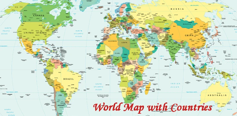
The World Map with Countries serves as a vital tool for understanding the intricate tapestry of our planet. It not only showcases continents and their respective nations but also highlights transcontinental countries, independent and dependent territories, oceans, seas, and islands—both large and small. This comprehensive representation encapsulates everything that exists on Earth.
Understanding the World Map with Countries
The World Map with Countries is more than just a visual aid; it is a detailed depiction of the Earth's surface. This map illustrates the geographic coordinate system through a network of lines representing meridians and parallels, which are essential for navigation and understanding global positioning.
The Political Landscape of the World
This political world map delineates all countries along with their administrative boundaries. Our planet is not only divided by geographical features but also by political divisions that play a crucial role in maintaining laws and order across nations. Understanding these boundaries is essential for grasping international relations and global governance.
What is a World Map?
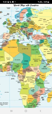
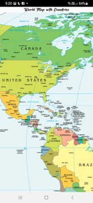
A world map is a graphical representation of the Earth's surface, providing a simplified yet informative view of our planet. It conveys a wealth of information about geographical features, including landmasses and bodies of water. The political map specifically highlights 197 countries, showcasing their international boundaries and surrounding water bodies.
Exploring the Seven Continents
The World Map with Countries categorizes the Earth into seven distinct continents, each with its unique characteristics:
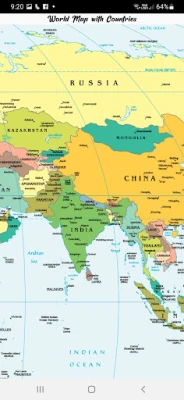
- Asia Map: The largest continent, home to diverse cultures, languages, and landscapes.
- Africa Map: Known for its rich history and biodiversity, Africa is the second-largest continent.
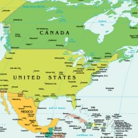
- North America Map: A continent characterized by its varied geography, from mountains to plains.
- South America Map: Famous for the Amazon rainforest and vibrant cultures.
- Antarctica Map: The coldest continent, largely uninhabited and covered in ice.
- Europe Map: A continent steeped in history, known for its cultural and political significance.
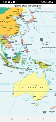
- Australia Map: The smallest continent, recognized for its unique wildlife and landscapes.
The Importance of World Maps in Education and Navigation
World maps are invaluable in educational settings, providing students with a visual understanding of geography, history, and global cultures. They serve as essential tools for teachers and learners alike, facilitating discussions about world events and international relations.
In navigation, world maps are crucial for travelers and explorers. They help individuals understand distances, routes, and geographical features, making them indispensable for both land and sea travel.
Conclusion: The World Map as a Reflection of Our Global Society
The World Map with Countries is not just a static image; it is a dynamic representation of our global society. It reflects the political, cultural, and geographical diversity of our planet. By understanding this map, we gain insights into the complexities of international relations and the interconnectedness of nations. Whether for educational purposes, navigation, or simply to satisfy curiosity, the world map remains a fundamental resource for anyone seeking to explore and understand our world.
Rate the App
User Reviews


Popular Apps


Editor's Choice